- Nature-based solutions
- Green-blue infrastructure
- Green-blue infrastructure in Huế
- Climate change and Huế
Nature-based solutions
Global warming and urbanisation are closely interconnected. Cities are both drivers of global warming and especially affected by its impacts. The need for climate mitigation and adaptation as well as building resilience is therefore becoming essential for urban policy. In this context, nature-based solutions (NBS) are gaining increasing importance in urban and regional planning.
Nature-based solutions are planning concepts and designed interventions that are inspired by nature and are intended to cope with ecological and social challenges such as temperature rise, water supply security, water and air pollution, food security, human health and disaster control. The ecosystem services provided by plants, water, soil and other natural elements are used to increase the sustainability and resilience of cities. Depending on the ecological and social challenge, the level of intervention and the spatial scale, a large number of measures can be summarised under the term nature-based solutions.
Examples:
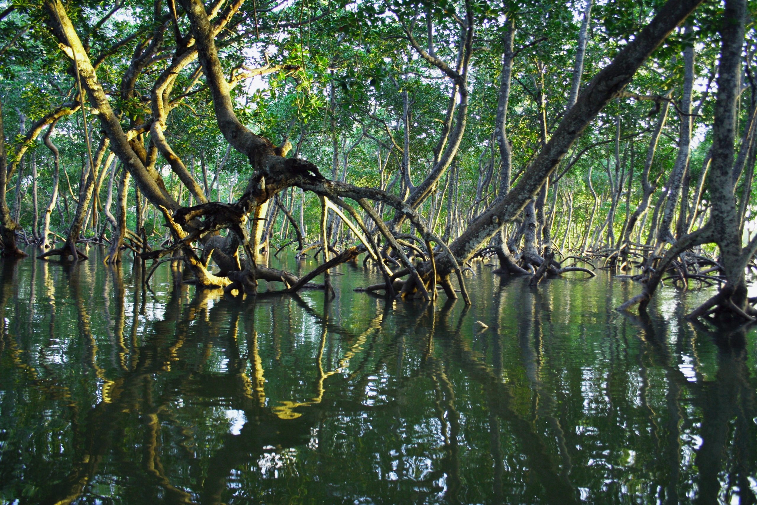
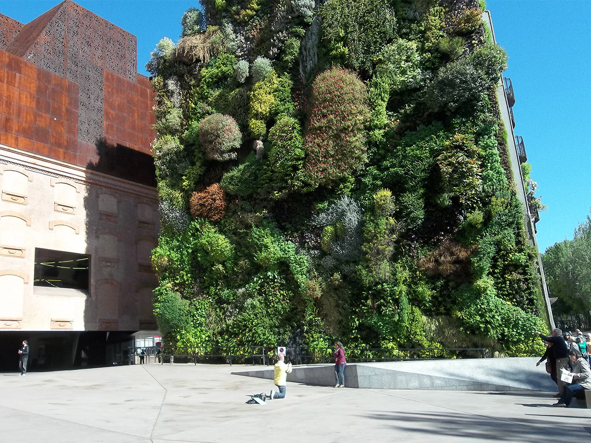
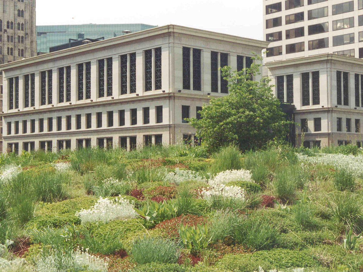
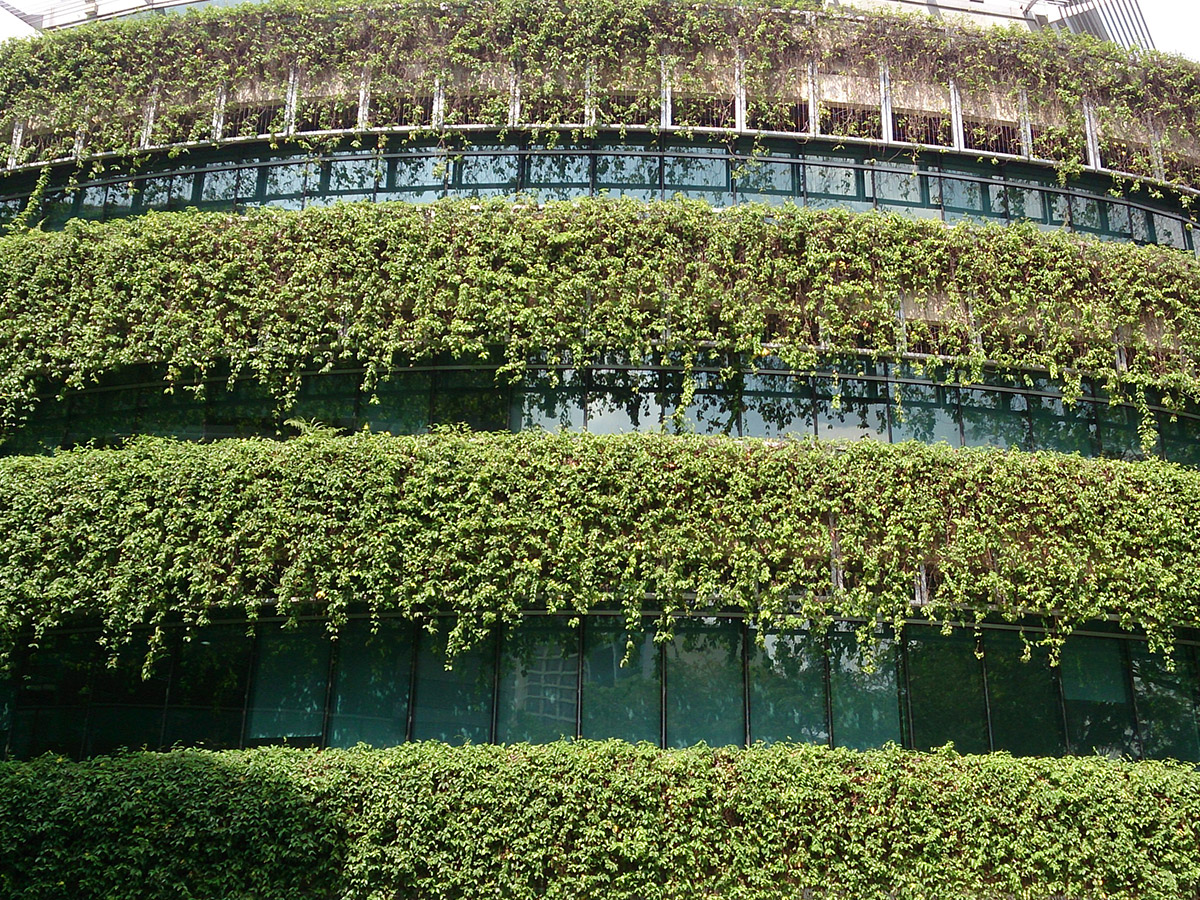
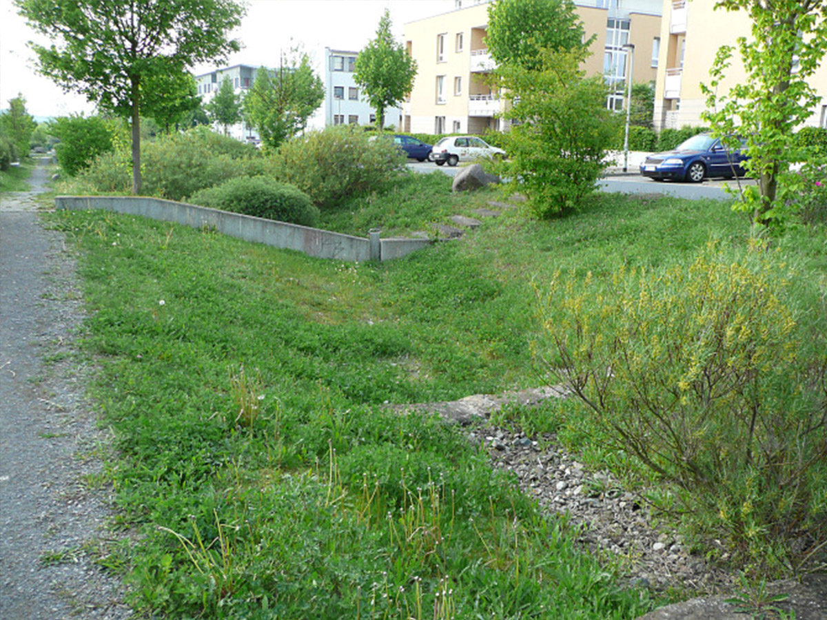
The restoring of wetlands and mangroves for the purpose of climate and coastal protection. The de-sealing of soils as well the reduction of the degree of soil sealing help to reduce surface run off following heavy precipitation events due to an increase in on-site infiltration while also increasing the evapotranspiration on site. Solutions like these restore the sustainability of the area and its multifunctionality. New designed and managed artificial ecosystems such as green roofs and vertical green can cool buildings in the summer and prevent heat loss in winter. Infiltration ditches and constructed wetlands which are designed for on-site water infiltration and treatment. Thereby, cooling the surrounding area.


Green-blue infrastructure
In an urban context, the concept of nature-based solutions aims at the improvement and expansion of green and blue infrastructures, a strategically planned network of natural and semi-natural areas covered with vegetation (green) or water (blue) that provide a wide range of ecosystem services for the city and its citizens. This includes urban forests, parks, cemeteries, allotment and private gardens, sports and leisure facilities, green roofs and facades (green infrastructures) as well as inner-city lakes, rivers, canals or fountains (blue infrastructures).
With regard to climate protection, the greatest effects can be achieved, in particular, through inner-city vegetation-covered green areas with unsealed soils. After the oceans and fossil fuels, unsealed soils are considered to be the world’s third largest carbon sink and store more carbon than the entire vegetation cover on earth (Paul et al. 2009). In the central areas of cities, however, soils are usually sealed over large areas. In urban areas, therefore, a decisive contribution to climate protection is to preserve the existing green infrastructure, in particular unsealed green spaces, as far as possible and to sustainably improve the storage of carbon in soils and vegetation. If they are already overbuilt and sealed, opportunities should be used to restore them, rebuild them and, if possible, unseal them. In addition to climate mitigation, green and blue infrastructures also play a central role in the area of climate adaptation. In urban areas, climatic conditions are influenced by the urban structure. In heavily compacted and sealed urban areas, surface runoff increases and real evapotranspiration, i.e. the evaporation of water, decreases. This is due to the fact that no water can be retained by the sealed soils and the lack of plant cover. This influences the heat balance in urban areas. Added to this is the increased heat storage capacity of concrete and asphalt. These have a low albedo value, i.e. a low reflectivity (ibid.). In densely populated inner city areas with a high degree of sealing, the temperature can be increased by two to three degrees Celsius compared to the surrounding area on hot summer days (Wessolek 2014). The heat load in densely populated inner city areas can have a negative impact on the quality of life and health of the urban population. On the other hand, green and blue infrastructures enable the evaporation of water, which is stored in the soils and in the plants and contributes to the cooling of the ambient air. In particular, trees that provide shade enhance this cooling effect and also help to improve air quality. On unsealed surfaces, rainwater can infiltrate directly into the soil and surface runoff, and thus the risk of flooding, decreases. When renewing city districts or building new city districts, a sufficient supply of green and open spaces must be planned from a climate protection and climate adaptation point of view. In urban districts in which it is not possible to restore or upgrade green spaces, roof and facade greening can also be used as green infrastructure elements, as they replace ecological functions of green and open spaces on sealed and built-up areas to a certain extent. They evaporate the retained water on site and shade the building surface. In doing so, they help improve the microclimate in urban areas during hot periods. In addition, precipitation peaks are reduced, thus relieving drainage systems and sewage treatment plants. Green roofs and facades also protect the building fabric from weather impacts and filter pollutants from the air.
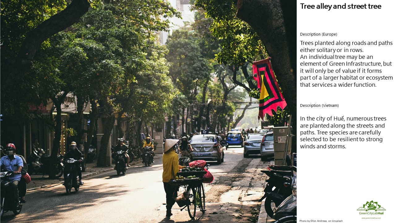
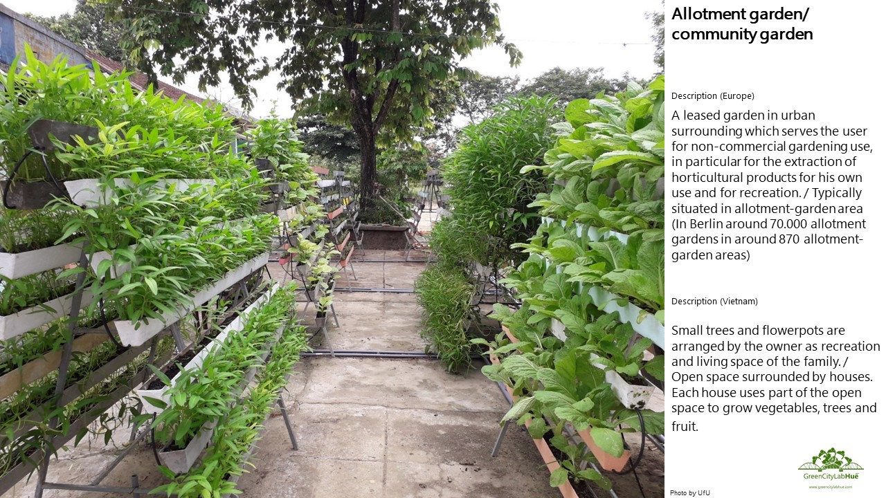
To identify relevant green and blue infrastructure elements in Huế, a case study typology was developed in a co-creation and co-learning process, including feedback loops between the Vietnamese and German partners. Thereby, green and blue infrastructure elements that can be found typically in Europe were adopted to the Vietnamese and in particular to the Huế context. As a result, the typology illustrates important green and blue infrastructure elements as understood by the Vietnamese and German project partners that are typical for Huế or Vietnam in general. These elements will be used in the future for the specification of scenarios on green and blue infrastructure development in the city. The full case study typology can be found here. Below you will find some selected examples of Huếspecific green and blue infrastructure elements.
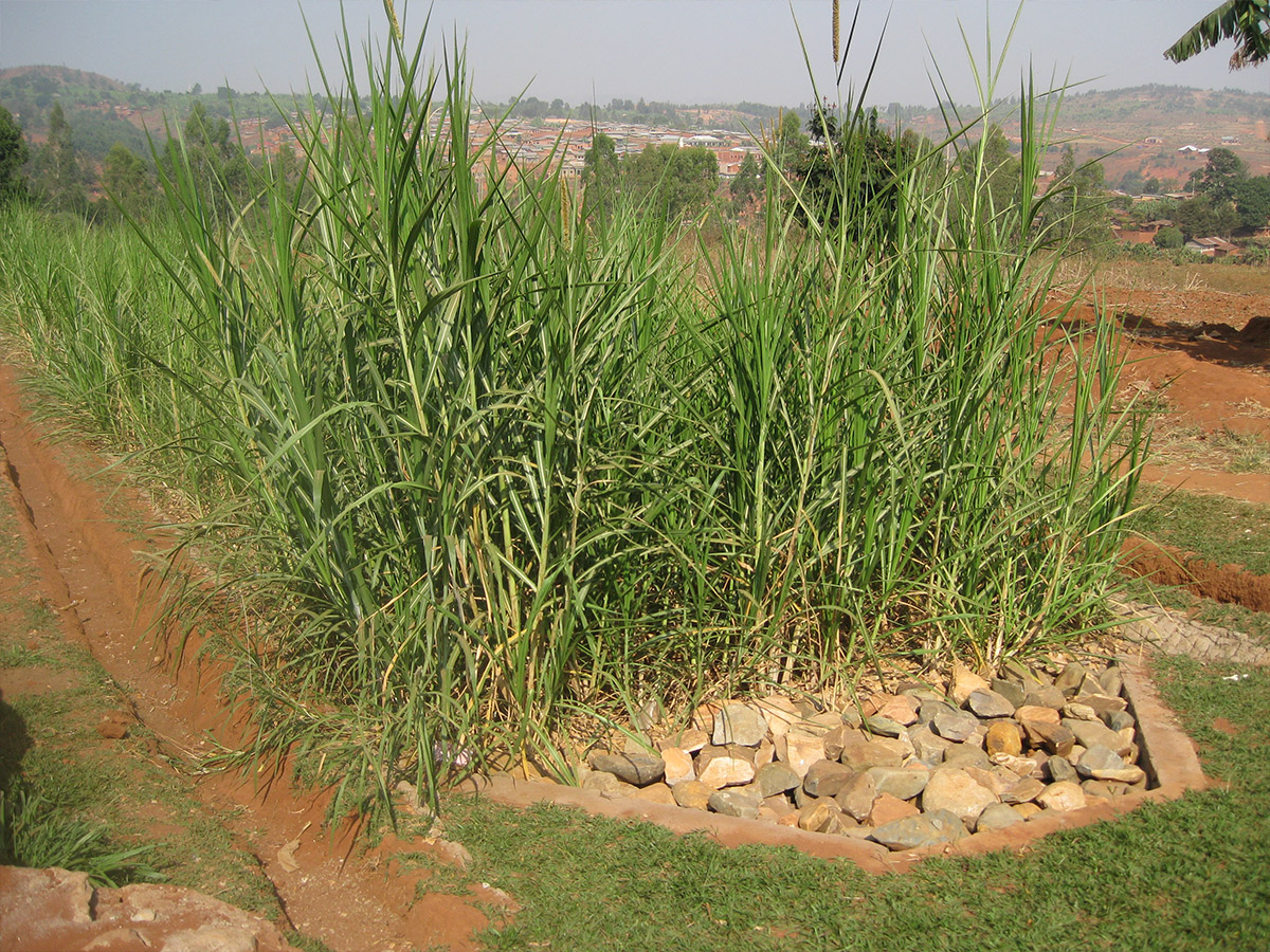
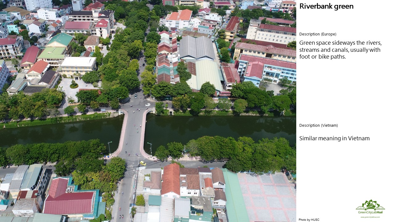
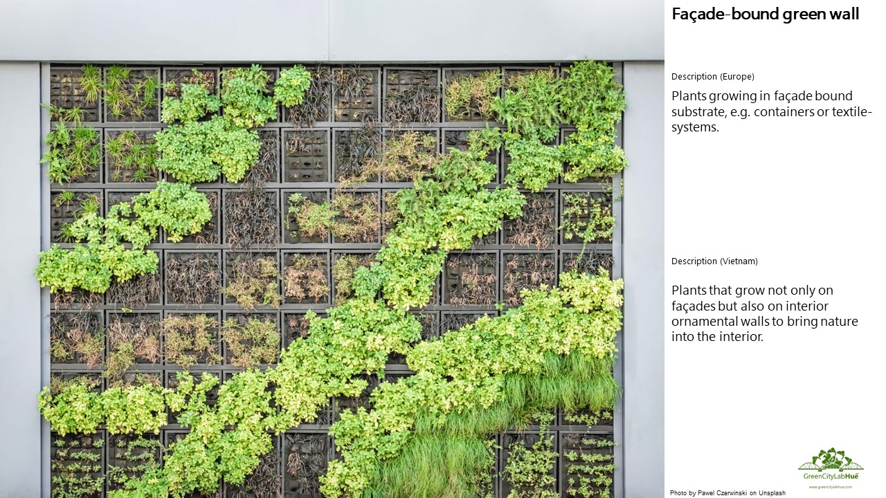
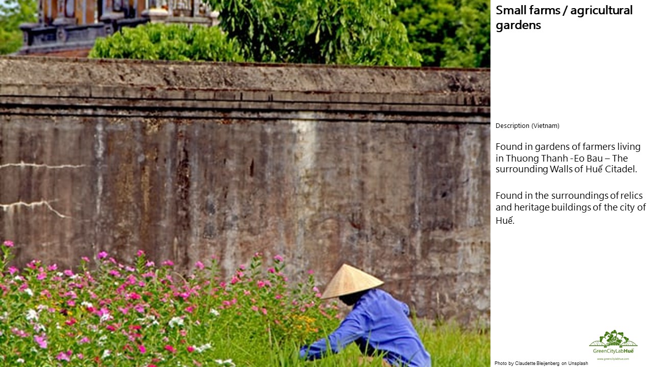
Examples:


Literature:
Wessolek, G. (2014): Bodenüberformung und -versiegelung. Handbuch
der Bodenkunde. 1: 1–35.
Paul, C./Weber, M./Mosandl, R. (2009): Kohlenstoffbindung junger Aufforstungsflächen. Literaturstudie. www.prima-klimaweltweit.de/grafiken/
pdf/paul_studie.pdf
Green-blue infrastructure
in Huế
Huế is a green city. With about 12.9 m²/person, the green space per capita is comparatively high. However, green (and blue) spaces are not equally distributed across the city – with access to green areas being particularly limited in the historical centre of the city – giving rise to the implementation of new GBI elements.
Huế is known as the “Garden City” and well-known for its typical garden houses, which contribute to a large amount of green space in the city. Those are located mostly in the wards of Kim Long, Thuan Thanh, Thuan Hoa and Tay Loc. About 4,228 garden houses with a size of at least 400 m² are located in Huế. The Huế garden houses are characterised by a large number of plantations (50 species per house), which create a high tree density and a corresponding ecosystem. Although the garden houses are considered a unique feature of the city, they are still faced with a loss in size and architecture due to economic motives, changes in function and modernisation trends. Due to the increase in residential areas with modern architecture, these structures with the natural features of vegetation and water are lost. The same applies to green areas integrated in the layout of properties of French colonial buildings.
Huế is located on a narrow plain with a slope from the west to east. The terrain comprises of low eroded hills on deeply weathered sedimentary rocks to the west of the city and depositional plains in the north and east. The historical centre of the city and its surroundings is built on flood plain, while areas below two meters are subject to frequent flooding.
The largest river system in Thừa Thiên Huế province is the Huong River system. It consists of the the Huong River and its three tributaries – the Bo, Ta Trach and Huu Trach. Its main course is 104 km long with a basin covering an area of 2,830 km², which is 56 % of the area of the province (HCCWG and Tran 2014). The highest density of blue infrastructure elements is located around the Citadel with a system of up to 48 lakes, ponds and the 3 km long canal of Ngu Ha with the total size of 810,420 m².
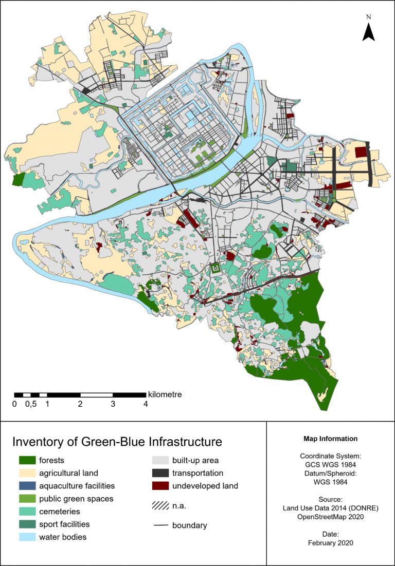
Inventory of Green and Blue Infrastructure
The GreenCityLabHuế analyzed the current distribution of natural and semi-natural green (vegetation covered) and blue (water covered) spaces within Huế city and its surroundings. The inventory of GBI presents the distribution of green, blue and open spaces in the city of Huế based on land use data from 2014. Although land use data form the basis of the inventory, it is actually a combination of land use and land cover. Nevertheless, the map provides a good overview of the distribution and share of GBI in the city of Huế.
The share of GBI in the urban area of Huế is as following: forest 6%, agricultural land 19.5%, aquaculture facilities 0.1%, public green spaces 1%, cemeteries 8%, sport facilities 0.4% and water bodies 10%. Forest and public green spaces not fairly distributed and potential for expansion of NBS can be seen in undeveloped land as well as new and growing urban areas in the Huong So, An Hoa, Thuy Xuan and Huong Long. In addition, potential for the enhancement of NBS can be found in densely populated areas and special zones, e.g. within the citadel.
Climate change and Huế
Huế city is located in a transitional climate zone, characterized by a humid tropical monsoon climate. During the summer months, the average temperature is 29°C to 30°C, with the highest temperatures between 38°C and 41°C in June and July. The dry season is from May to September with dry air caused by southwestern winds. During the winter months, the average temperature fluctuates between 20°C and 23°C. The rainy season from October to April is influenced by the northeast monsoon, which causes significant rainfall (HCCWG and Tran 2014; Fick and Hijmans 2017). The rain intensity in Huế is one of the highest rates in Vietnam. Therefore, Thua Thien-Huế province is considered as the most prone to flooding in Vietnam. Rainfall is unevenly distributed between months and mainly focuses on the rainy season, with October and November contributing over 30% to the annual rainfall.
Today, Huế is affected by the impact of climate change. The most obvious are extreme weather events such as extreme heat waves and storms with heavy rainfalls leading to flooding in the city and the Thua Thien Huế province. In the near future, climate conditions are predicted to change to varying degrees, depending on the models. During the defining phase of the GreenCityLabHuế Project, current climate conditions were assessed based on long-term measurements from 1960-1990 and future conditions were obtained from averaging six models and detailed global climate data from the 5th Assessment Report of the Intergovernmental Panel on Climate Change (IPCC).
The IPCC generally uses four scenarios to predict possible future climate conditions based on possible future scenarios of greenhouse gas concentrations in the atmosphere. All four scenarios are based on different future greenhouse gas emissions depending on upcoming emissions, whereby RCP 2.6 assumes the lowest and RCP 8.5 the quantitative highest future greenhouse gas emissions, which is, unfortunately, more likely.
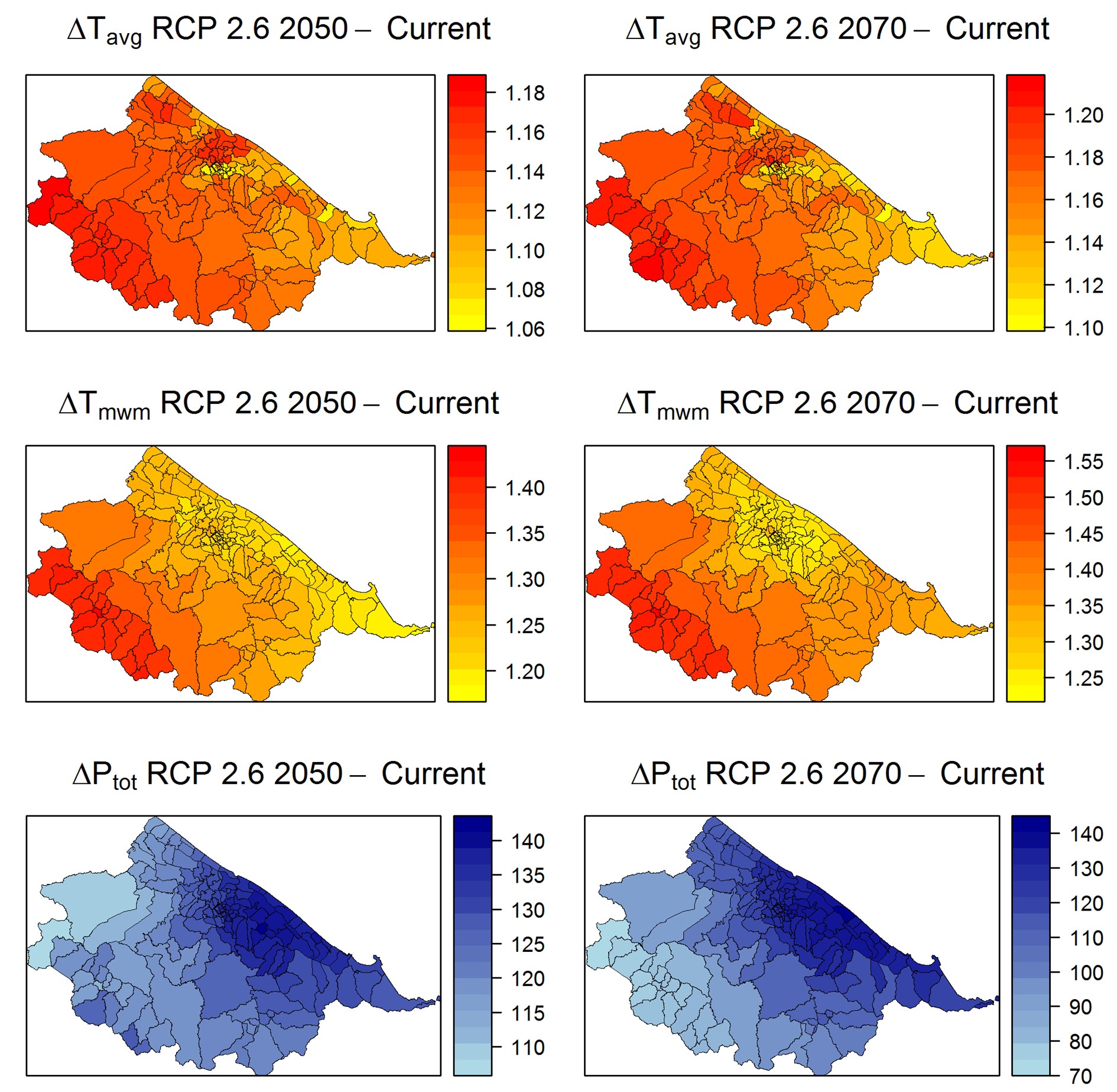
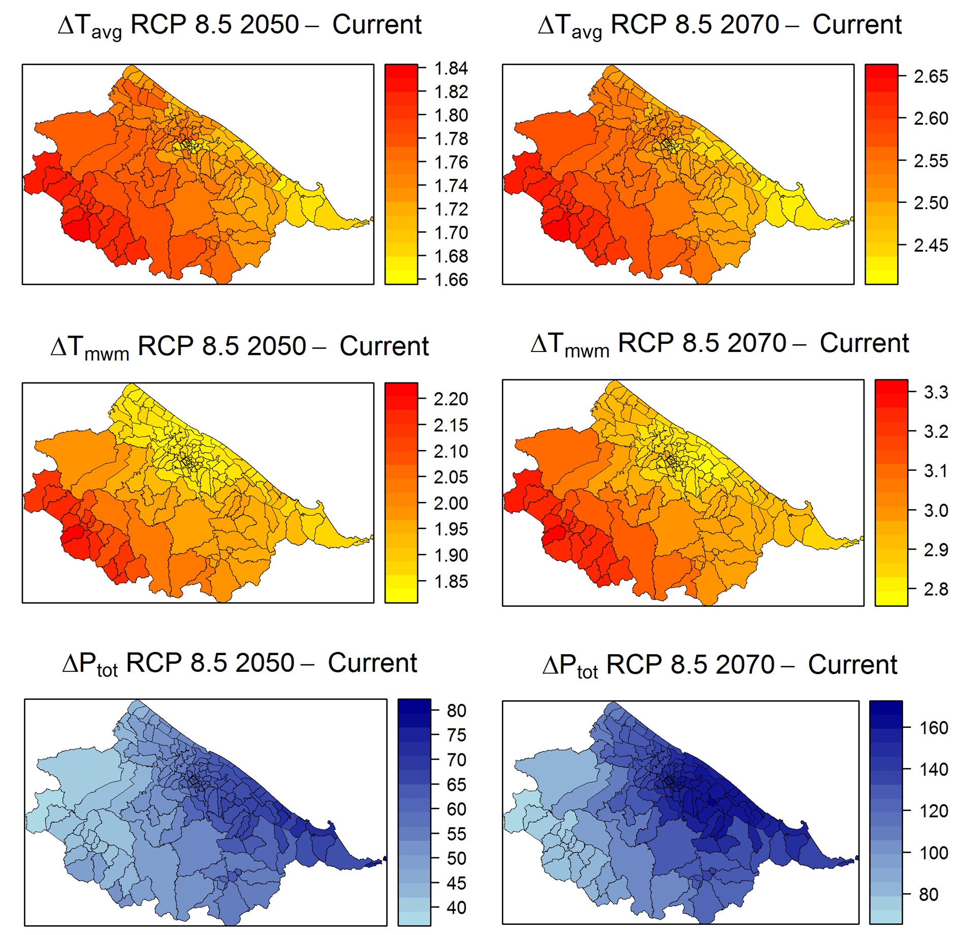
The images show future climate conditions in Huế under two scenarios RCP2.6 and RCP8.5, expressed as the difference from current conditions and averaged at the city level in the years 2050 (left) and 2070 (right). You can change the scenario displayed by moving the green button with the mouse left for RCP8.5 or right for RCP2.6.
Observable trends for future climate conditions in Huế show generally warmer air temperatures and increased total precipitation for today’s humid-tropical region. Details are listed below:
- The annual mean near-surface air temperature is projected to increase by about 1.07°C to 1.83°C by 2050 and about 1.11°C to 2.65°C by 2070
- Temperature extremes, measured as the warmest month’s maximum, will increase by about 1.18°C to 2.20°C through 2050 and 1.24°C to 3.30°C through 2070
- Total annual precipitation increases by 38.97mm to 79.33mm (RCP8.5 scenario) and by 108.10mm to 141.20mm (RCP2.6 scenario) until 2050 and by 71.92mm to 165.86mm (scenario RCP8.5) and by 74.53mm to 140.41mm (Scenario RCP2.6) by 2070
- Natural hazards are likely to be exacerbated by climate change, including an increase in heat waves and resulting heat stress and flooding.
- At the same time, air quality can be affected.
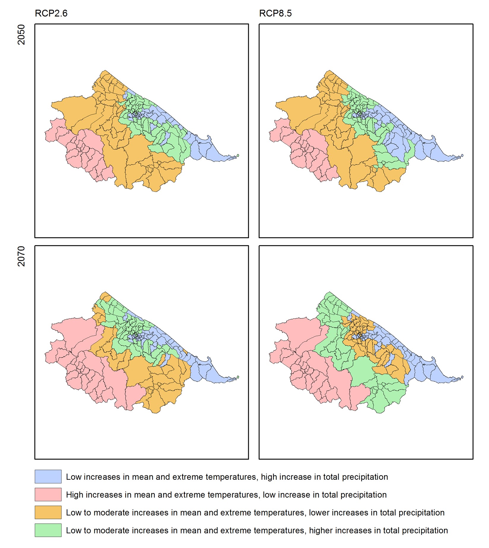
The following figure shows the Thua Thien Huế province and possible future changes due to climate change for different parts of the province under RCP2.6 and RCP8.5 scenarios.
Literature
Anh, T. T., Phong, T. V. G., Tuan, T. H., & Mulenga, M. (2013): Community consultation for long-term climate-resilient housing in Vietnamese cities: a comparative case study between Huế and Da Nang. Asian Cities Climate Resilience, IIED.
Asian Development Bank (ADB) (2015): Huế GrEEEn City Action Plan: Main report. Online: https://www.adb.org/sites/default/files/publication/179170/Huế-greeen-city-ap.pdf.
Dang, T. N., Seposo, X. T., Duc, N. H. C., Thang, T. B., An, D. D., Hang, L. T. M., & Honda, Y. (2016): Characterizing the relationship between temperature and mortality in tropical and subtropical cities: a distributed lag non-linear model analysis in Huế, Viet Nam, 2009–2013. Global health action, 9(1), 28738.
Kreft, S., Eckstein, D., Junghans, L., Kerestan, C. and Hagen, U. (2015): Global Climate Risk Index 2015. Who Suffers Most From Extreme Weather Events? Briefing Paper. Germanwatch 2015.
UNDP (2008): Climate Change and Human Development in Vietnam, UNDP Human Development report 2007/2008. Online: http://hdr.undp.org/sites/default/files/chaudhry_peter_and_ruysschaert_greet.pdf.
The project is funded by
The project is implemented by


